

Ullr's Mobile Avalanche Safety Tools app for iPhone and iPad
Developer: Ullr Labs LLC
First release : 11 Nov 2011
App size: 25.27 Mb
Featured in Outside Magazine & The Avalanche Review.
"Think of this, the most advanced backcountry app available, as another tool in your snow-safety toolbox." -Outside Magazine
Ullr Labs’ Mobile Avalanche Safety Tools (MAST) combines iPhone technology with established snow science to improve winter backcountry travel decisions, make it easy to share observations and adventures, and provide ongoing resources to increase avalanche knowledge and awareness.
We bring the features of gps, camera, compass, clinometer and snowpit book together in one easy-to-use tool*. With MAST you can:
•Download and read the most recent avalanche forecasts for your area.
•Review conditions recently reported by other users.
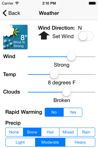
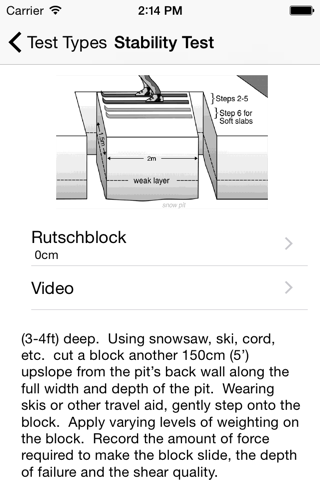
•Easily collect information about snow, weather and terrain conditions and avalanche sightings on your trips, using well-established snow science definitions and guidelines.
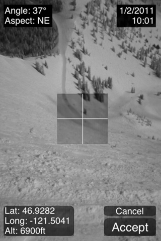
•Record location, elevation, slope angle and a photo of the area in one easy step**--supports metric and imperial units.
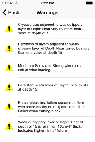
•Receive warnings when recorded conditions and test results are at levels that avalanche science considers high-risk.
•Share your observations with the regional avalanche center (US only) and backcountry community in your area.
•Link to various educational resources to increase your knowledge of snow and avalanche science.
*GPS and Camera support only in devices equipped with those features.
**Slope Camera View iPhone/iPod only.
Latest reviews of Ullr's Mobile Avalanche Safety Tools app for iPhone and iPad
Used this app in the Wasatch. Was very easy to record data. Especially like the ability to automatically record position, slope angle, and aspect. All SWAG compatible nomenclature. Easy to enter using standard iPhone number wheels. Nice to be able to complete the pit documentation as you enter it. Once everyone starts using it and uploading their OBS as they take them, it will be a new breakthrough in social media (a true face book). Imagine checking snow pit data collected by all local tourers while you are in your assessment process in the field! Sarge
The pit diagrams look like they were drawn by a little kid, not professional at all. Doesnt have most of the weather fields that professionals need. And you cant change the units. Clearly not meant for professionals, or even serious recreation backcountry skiers.
This avalanche application is user friendly, well designed and standardized. It follows current SWAG (Snow, Weather, Avalanches observation Guidelines). It allows for information exchange with your local and participating Avalanche Center by allowing the communication of avalanche, snowpack and weather observations. As a AIARE Level 1 or 2 graduate, it will help consolidate the material learned in both courses: anything from the big picture (red flags) covered in L1 to the more detailed snow science covered in L2. Greatly recommended to anyone interested in this fascinating and complex subject. Which Dragon today??
A very good tool for recording snow analyses. I use it in my patrol job for an easy, clear, and concise printout for the records. Just remember to practice with it so you can become familiar with all the inputs and functions.